Specialized Technical & Commercial Drone Service
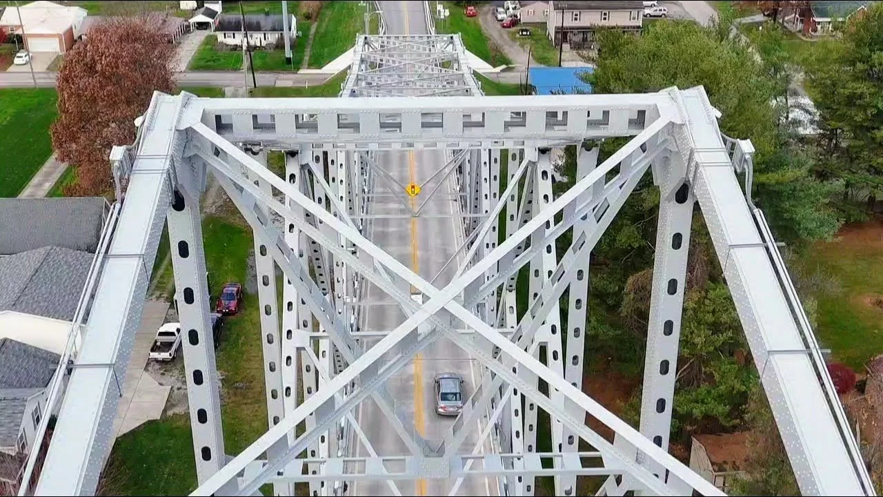
Inspections & Asset Management
Detailed structural assessments for bridges, power lines, and wind turbines using high-resolution imaging and thermal technology. Comprehensive asset management for Oil & Gas ensures safety and compliance through data-driven insights.
Construction & Surveying
High-tech solutions for construction site monitoring, including aerial photography, GIS data, 3D mapping, and Orthomosaic Maps for urban planning and resource management.
Mining & Aggregates
Enhance safety and efficiency with advanced scanning for inventory management, mine planning, and surveillance. Generate accurate 3D models and precise data to reduce operational costs.
Public Safety & Emergency Response
Critical aerial support for law enforcement and first responders, including search and rescue, traffic collision reconstruction, and event monitoring. Provides real-time aerial surveillance from a safe distance.
Agricultural Drone Services
Precision farming with NDVI mapping and specialized data for crop health monitoring and yield optimization.
Advanced Data Acquisition
Cutting-edge technology for specialized data collection:
LiDAR: Detailed topographic maps for forestry and flood risk analysis.
Thermal Imaging: Building diagnostics and search & rescue.
Research Data: High-quality datasets for scientific and industrial applications.